How do climate and geography influence life in Canada for immigrants?
In this blog, we dive into how Canada’s climate and geography shape the experiences of immigrants. From adapting to diverse weather conditions to choosing where to live, we’ll uncover how these natural elements play a significant role in the immigrant journey in Canada. Join us as we untangle the threads of climate and geography, revealing their influence on the daily lives of those who call Canada home.
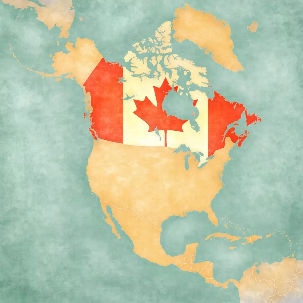
A Comparative Overview of the Canadian provinces and territories
In terms of developmental history and economic standing, Canada’s democratic state closely aligns with the United States. Despite being the world’s second-largest country, Canada’s population in 2011, just over thirty-four million, was smaller than California’s. Notably, over 90 percent of Canadians reside within 150 miles of the US border, emphasizing the concentrated habitation near this boundary. Northern Canada, excluded from the ecumene, lacks conditions for permanent human settlement. The suitable climate for agriculture and widespread settlement is limited to a narrow band in southern and eastern Canada. The strong economic ties with the United States explain the preference for living close to the US border. With ten provinces and three territories, Canada’s capital is Ottawa, while Toronto stands as its largest city.
Physical Geography of Canada
Population Distribution
Ontario leads with the highest population at around 39%, followed by Quebec, the predominantly French-speaking province, with approximately 23%. Noteworthy percentages reside in British Columbia (13%), the prairies (18%), and along the Atlantic coast (7%), while the vast northern regions house just a third of 1% of the population.
Climate Variations
Central Canada experiences Type D (continental) climates, characterized by warm summers and cold winters. Rainfall varies from eighty to one hundred inches annually on the West Coast, while the Maritime Provinces receive up to sixty inches. Nunavut in the north barely gets ten inches, mainly in the form of snow. The Arctic Type E climate in far northern Canada is so harsh that only a few people inhabit it, influencing popular sports like ice hockey.
Natural Resources
The Canadian Shield around Hudson Bay and surrounding areas provide timber and minerals. The Maritime Provinces focus on fishing and agriculture, while the St. Lawrence River region and Prairie Provinces contribute dairy, agriculture, and significant farmland. Alberta, a hub for fossil fuel exploration, exports abundant coal, oil, and natural gas, including oil extracted from tar sands. The Rocky Mountains and coastal ranges in western Canada support mining and lumber mills, with Vancouver serving as a crucial port for Pacific Rim trade. The Yukon Territory, amid mountains, experienced a gold rush.
Economic Impact
Natural resources, including fossil fuels, mining, and lumber, contribute to Canada’s wealth. Edmonton’s professional hockey team, the Edmonton Oilers, reflects the cultural integration of natural resources, particularly in fossil fuel exploration. Projections suggest that Canada’s tar sands may hold more oil than Saudi Arabia’s underground reserves.
Find out if you are eligible to get in Canada →
Climate change adaptation in Canada
Canada is experiencing evident shifts in its climate, marked by higher temperatures, altered rainfall patterns, extreme weather events, and rising sea levels. These changes are already impacting various facets of Canadian life.
Anticipated climate changes are expected to persist and, in many instances, intensify in the coming decades. This will wield substantial influence over Canadian communities, affecting the economy, social well-being (including health and culture), and the environment. To foster resilience, mitigate risks, and curb the costs associated with climate change impacts, it is imperative to comprehend these effects. Understanding the available options is essential for informed decision-making in the pursuit of a climate-adaptive and sustainable future.
Navigating impacts and opportunities for climate change adaptation
Climate change adaptation encompasses activities aimed at lessening the adverse effects of climate change, aiding in coping with them, and capitalizing on emerging opportunities resulting from climate shifts.
Distinguished from mitigation efforts that reduce the rate and scale of climate change, adaptation is focused on both present and future impacts. Successful adaptation doesn’t guarantee the absence of negative consequences but strives to mitigate their severity.
This process entails adjustments in decision-making, activities, and mindset in response to evolving climate conditions. A dedicated focus on adaptation involves comprehending the implications of climate change for Canadian residents, identifying effective approaches to tackle climate change impacts, and addressing existing gaps in knowledge and action.
Since 1998, the climate change impacts and adaptation division of natural resources Canada has been actively engaged in research and initiatives related to climate change impacts and adaptation. Leveraging extensive expertise and a broad network of external experts and partners, the division leads national assessment processes, delivers Canada’s climate change adaptation platform, and spearheads a program co-funding projects to overcome key knowledge and capacity barriers to adaptation, particularly for communities and natural resource sectors.
Areas affected by climate change in Canada
Canada’s North
Positioned in the northern hemisphere, Canada undergoes climate change at twice the global average rate. The Canadian Arctic experiences an even more accelerated warming—approximately three times the global rate. This rapid warming poses risks to northern communities and infrastructure due to sea-ice deterioration and permafrost changes. The Geological Survey of Canada (GSC) conducts vital geoscience research to inform land-use planning, aiding communities, industries, and regulators in adapting to changing environments in Canada’s North.
Coastlines
Surrounded by the Pacific, Arctic, and Atlantic Oceans, Canada faces climate change impacts on various ocean properties, including temperature, sea ice, sea level, acidity, and dissolved oxygen. Coastal communities are at an increased risk of flooding due to sea-level rise and extreme high-water events. The Geological Survey of Canada provides essential information, including relative sea-level projections, supporting planning, and adaptation tools like Fisheries and Oceans Canada’s Canadian Extreme Water Level Adaptation Tool.
Forests
Canada’s vast forests, covering a substantial land area and storing significant carbon, make global forest management a critical concern. The Canadian Forest Service (CFS) is actively identifying options for the forest sector to adapt to climate change. This includes leveraging new knowledge to reduce risks to ecosystems and optimize potential benefits. Collaborating with provinces, territories, universities, and industry, the CFS develops decision support tools for managers and policymakers, ensuring a proactive approach to climate change adaptation in Canada’s forests.
Trading partners and economic shift in the Canadian Economy
Trade Relations
Canada and the United States maintain a significant trade partnership, with over 80% of Canadian exports going to the U.S. and 70% of Canadian imports coming from its southern neighbor. Most businesses, except for some natural-resource industries, are centered in Canadian cities to leverage the available labor force.
Transition to Knowledge-Based Economy
Canada is swiftly transitioning to a knowledge-based economy driven by innovation and technology. Knowledge-intensive industries like biotechnology and information technology are on the rise, typically located in cities to foster collaboration with universities and researchers.
Natural Resource Foundations
While evolving into a knowledge-based economy, Canada’s economic roots have always been its abundant natural resources. Primary industries, including agriculture, fishing, mining, fuel/energy, and logging/forestry, historically played a crucial role. However, they now constitute less than 10% of the GDP. The service sector, employing three-quarters of Canadians, is a dominant force, contributing over 60% to the GDP. Canadian manufacturing, closely tied to the U.S. and multinational corporations, remains a substantial sector.
Currency Impact and Trade Dynamics
Canada’s economy is closely linked to the U.S., evident in fluctuations based on the strength of the Canadian dollar against the U.S. dollar. Examples include the impact on film and television industries depending on currency valuation. The 1994 NAFTA agreement further solidified Canada’s access to U.S. and Mexican markets, eliminating tariffs and setting rules for various sectors, including finance, transportation, and telecommunications.
Cultural Influence and Identity
The geographical proximity and cultural similarities between Canada and the U.S. result in the adoption of American trends by Canadians. While legal issues, laws, and healthcare differentiate the two, Canada remains a significant consumer of American popular culture. Concerns about cultural extinction led to regulations ensuring Canadian content in broadcasts, while others believed exposure to American culture strengthens the Canadian identity.
In summary, our exploration of how climate and geography influence life for immigrants in Canada reveals a captivating tapestry of adaptation and resilience. The diverse landscapes and varying weather conditions are not just elements of nature; they intricately shape the immigrant experience. Navigating the Canadian seasons and choosing communities within the vast geography become integral aspects of this journey. Ultimately, immigrants forge a unique connection with the natural elements, transforming challenges into opportunities. Through the lens of climate and geography, we witness a resilient community thriving amidst the beauty and challenges of their adopted home, Canada.